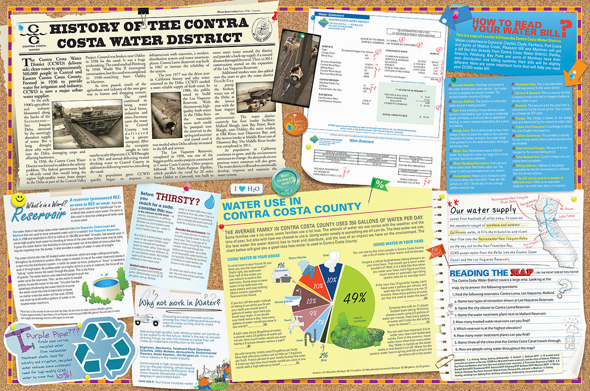
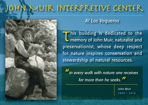
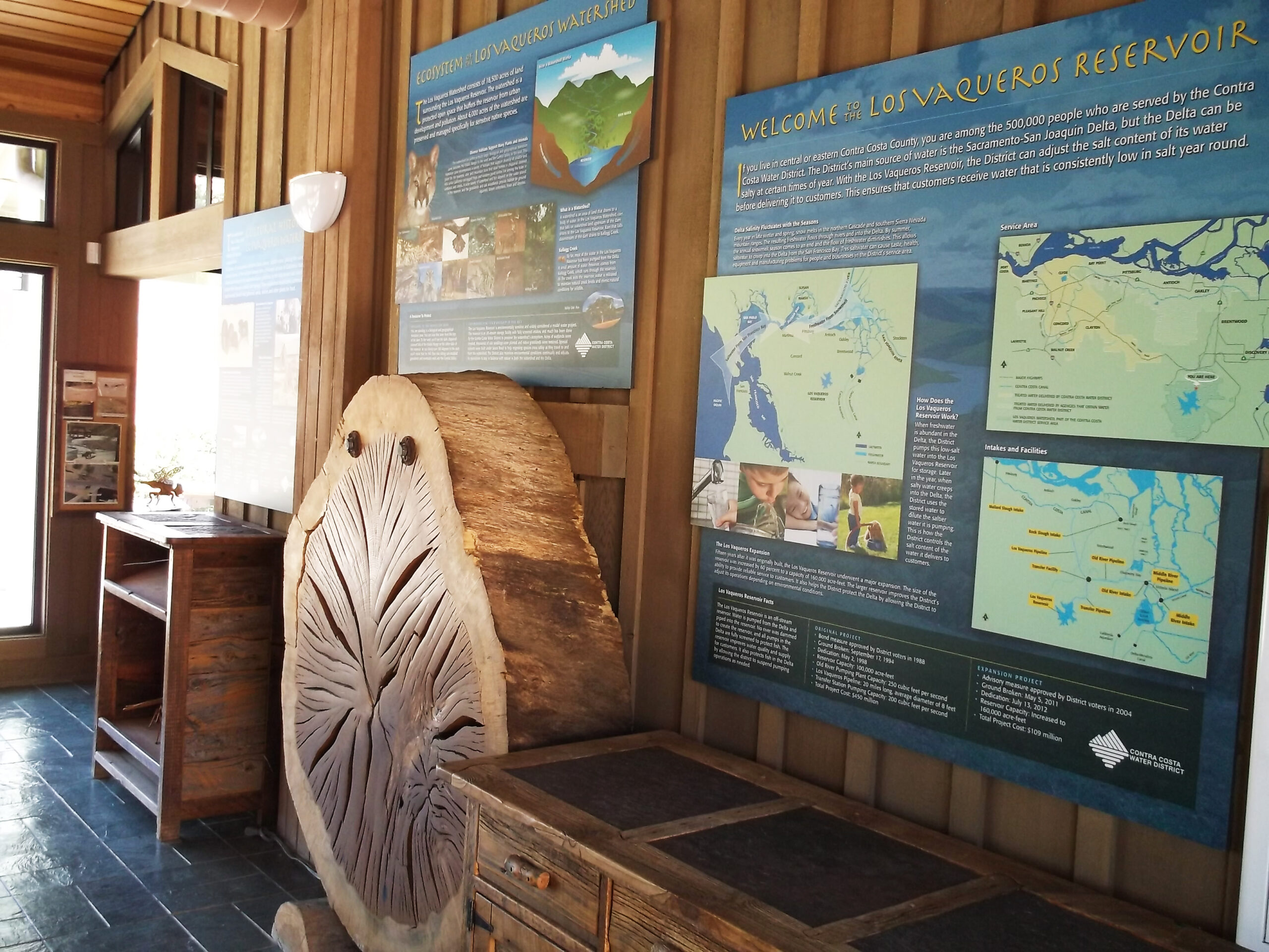
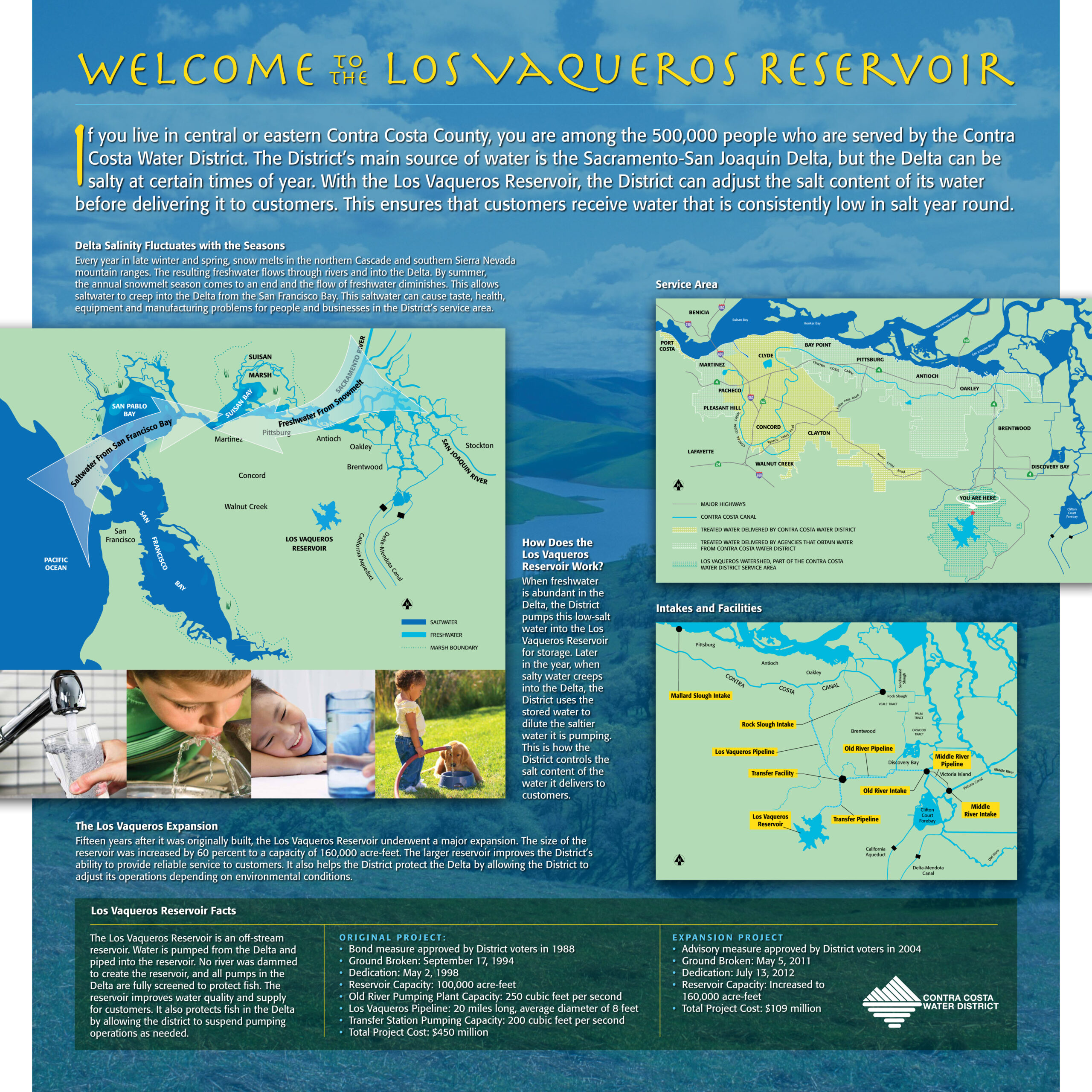
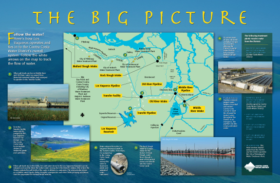
I created this map to illustrate the canal systems of the Contra Costa water district as part of their 5th grade Marine Biology curriculum. Front and back sides serve as a teaching tool covering public water works, canal safety as well as many local landmarks and the role they play in the big water picture. The John Muir Interpretive Center at Los Vaqueros reservoir is featured, I designed the information graphics for the Visitors Center as well.
